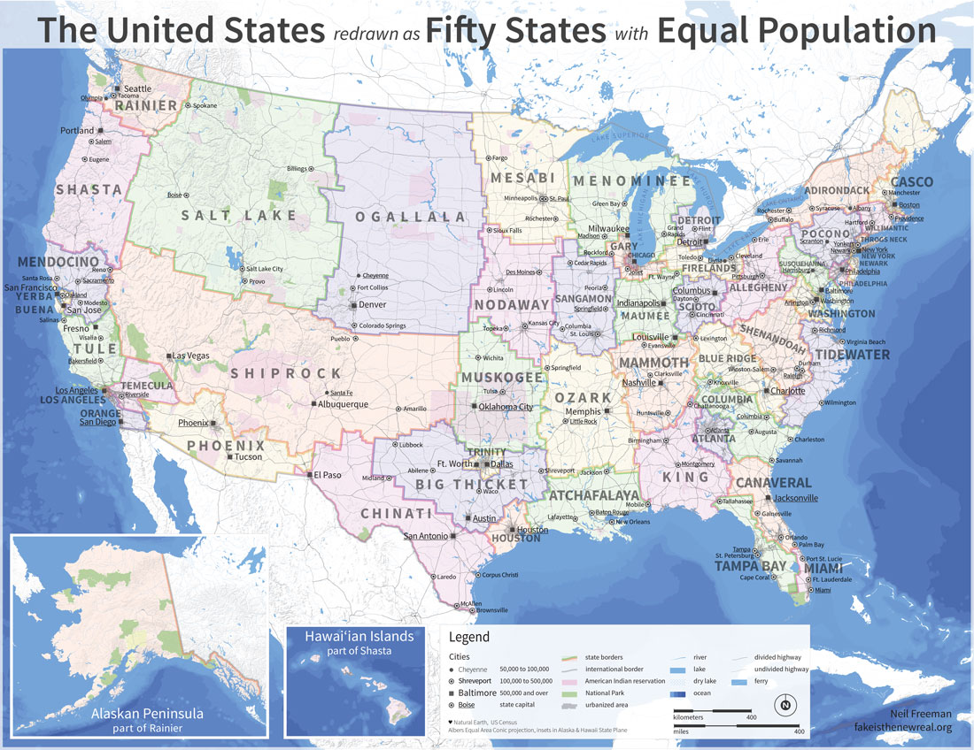
I quote from the article from which this map is drawn:
What if American state borders were redrawn such that each of the 50 had an approximately equal population? Well, it might look a little something like this map drawn by Neil Freeman and described as an electoral college reform proposal. In partisan terms, by packing so many liberals into incredibly lopsided urban states this concept would tilt the college in favor of the GOP. Nate Cohen, for example, has calculated that Mitt Romney would have won a narrow electoral college victory under this map in 2012, despite losing the popular vote by four percentage points. But there would be broader policy implications of creating several city-states that wouldn't be subordinated to state legislatures and would send their own urban-focused senators to Washington. This remapped America would have more non-white statewide elected officials, and give politics less of a pronounced regional schism.Of course, one would also change the Constitution to have direct election of the president; the electoral college is an absurdity. Assuming that the county continued to have a bicameral legislature, since 81 percent of the population lives in urban or suburban areas, the lower body would represent urban interests. The upper body would apparently represent rural interests. But of course, the state boundaries would shift from census to census, as do the legislative districts now.
No comments:
Post a Comment