I have been reading
The Scramble for Africa: White Man's Conquest of the Dark Continent from 1876 to 1912 by Thomas Pakenham. (
See my previous post.) I am struck by how recent it was that the imperial powers divided Africa among themselves -- basically a 40 year period (ending with the transfer of the German colonies to the victors of World War I). The following maps show a great deal about the process in which the imperial powers moved out from their footholds on the coast of Sub-Saharan Africa to control the interior, and as the European imperial powers took over control of North Africa from the dying Ottoman Empire.
Africa Before the Scramble, 1876
As late as 1876, European empires controlled limited areas on the coast of Africa. The Ottoman empire still held nominal sovereignty over a large area of north Africa and the Nile River valley and the related areas of Egypt and the Sudan. Muslim traders and slavers controlled an area in the east, notably the areas shown as controlled by the Sultanate of Zanzibar (see
my related post).
By 1912, European empires controlled almost all of Africa, with Germany holding large areas in east Africa and south west Africa, areas it was to lose as a result of World War I. Madagascar, although not so shown on the map, was French at this point.
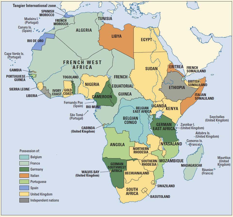
Colonial Africa 1912
Colonial Africa 1920 - 39
By 1920 France (blue) now has a huge holding in north-west Africa and Madagascar. Britain (red and pink) controls a band from the southern tip of Africa up through east Africa to and including Egypt with holdings in the west including Nigeria, the Gold Coast and Sierra Leone. Portugal (dark green) holds Angola and Mozambique, but much expanded inland from the territory it controlled in 1876. Italy (light green) holds Somaliland, Eritria and Lybia. Spain (yellow) holds small colonies close to Spain itself. Only Liberia (ruled by repatriated blacks from America) and Ethiopia (the areas in grey) remain independent of European imperial control.
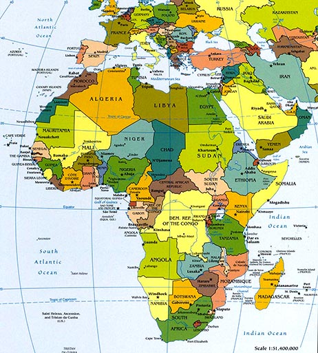
Modern Political Map of Africa
After World War II there was a wave of decolonization leading to independence for the African nations. However, many of the boundaries created by the European empires remained as boundaries of modern African states.
Since the European imperial powers didn't consider the tribal origins of the people living in the areas that they grabbed in the scramble for Africa, today many ethnic homelands are divided by national borders left over from the days of imperial colonization.


No comments:
Post a Comment